Quintana Roo in Mexico: what to see and what to do in the region?
Quintana Roo and the Riviera Maya occupy a massive limestone plateau in Mexico that extends into the Caribbean Sea, creating the foundation for one of the world’s largest underground river systems and extensive coral reef networks. This geological structure produces the region’s characteristic cenotes—freshwater sinkholes that punctuate the landscape—and supports the Mesoamerican Reef System, the second-largest coral reef in the world.
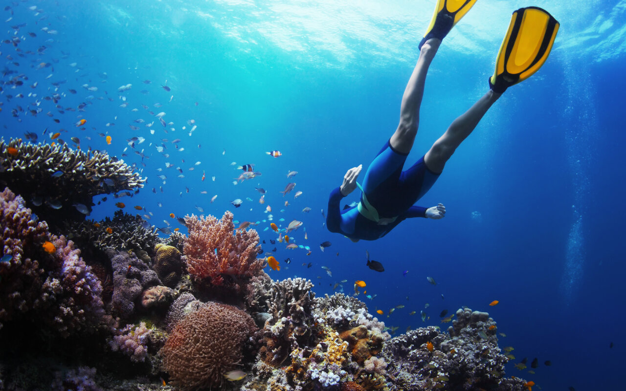
The state stretches along 865 kilometers of Caribbean coastline, where the limestone bedrock creates white sand beaches and supports coral formations that harbor over 500 fish species and 65 coral types.

Sian Ka’an Biosphere Reserve
This UNESCO World Heritage site encompasses 528,000 hectares of tropical forests, wetlands, and marine environments near the Belize border. Sian Ka’an, meaning “where the sky is born” in Mayan, protects critical habitat for West Indian manatees, Morelet’s crocodiles, and over 300 bird species including jabiru storks and roseate spoonbills.
The reserve contains 23 archaeological sites and supports traditional Mayan fishing and agriculture practices. Visitors can explore the ancient canal system built by the Maya between 400-1200 CE, which connected coastal lagoons and enabled trade throughout the region.

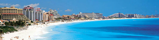
Cancún: planned resort development
Created in 1970 as a computer-selected tourism development project, Cancún transformed from a fishing village of 117 people into a city of 800,000 residents. The Hotel Zone occupies a 7-shaped barrier island connected to the mainland by two bridges, featuring 150 hotels and resorts along 22 kilometers of beaches.
The city serves as the entry point for 6 million international visitors annually, with direct flights from over 60 cities worldwide. Despite intensive development, nearby reefs like MUSA (Underwater Museum of Art) combine conservation with tourism through 500 life-sized sculptures that serve as artificial reef structures.
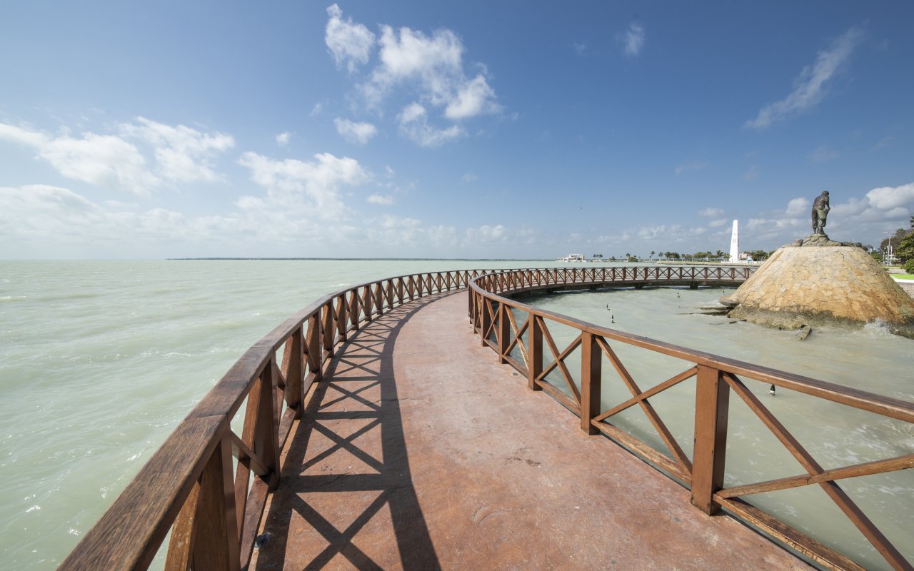
Isla Mujeres: traditional fishing culture
Located 13 kilometers off Cancún’s coast, this 8-kilometer-long island maintains its character as a fishing community while accommodating tourism. The island’s economy traditionally centered on fishing and salt production, practices that continue alongside tourism development.
Playa Norte consistently ranks among Mexico’s top beaches due to its shallow, calm waters and fine white sand. The island’s compact size—just 2 kilometers wide at its broadest point—makes golf cart and bicycle transportation practical alternatives to cars.
Playa El Garrafón functions as a natural aquarium where the coral reef comes within 20 meters of shore, allowing snorkeling access to parrotfish, angelfish, and rays in water depths of 3-10 meters.
The island’s interior contains remnants of Mayan structures dedicated to Ixchel, goddess of fertility and medicine, which likely gave the island its Spanish name meaning “Island of Women.”


Playa del Carmen: European tourism hub
Positioned 68 kilometers south of Cancún, Playa del Carmen has grown from 1,500 residents in 1990 to over 300,000 today, making it one of Mexico’s fastest-growing cities. The town appeals particularly to European tourists seeking smaller-scale accommodations and easy access to archaeological sites.
Quinta Avenida (Fifth Avenue) runs parallel to the beach for 4 kilometers, lined with restaurants, bars, and shops in low-rise buildings that maintain human scale despite rapid development. The pedestrian-only street connects three distinct zones: the ferry dock area with budget accommodations, the central tourist district, and the quieter residential Colosio area.
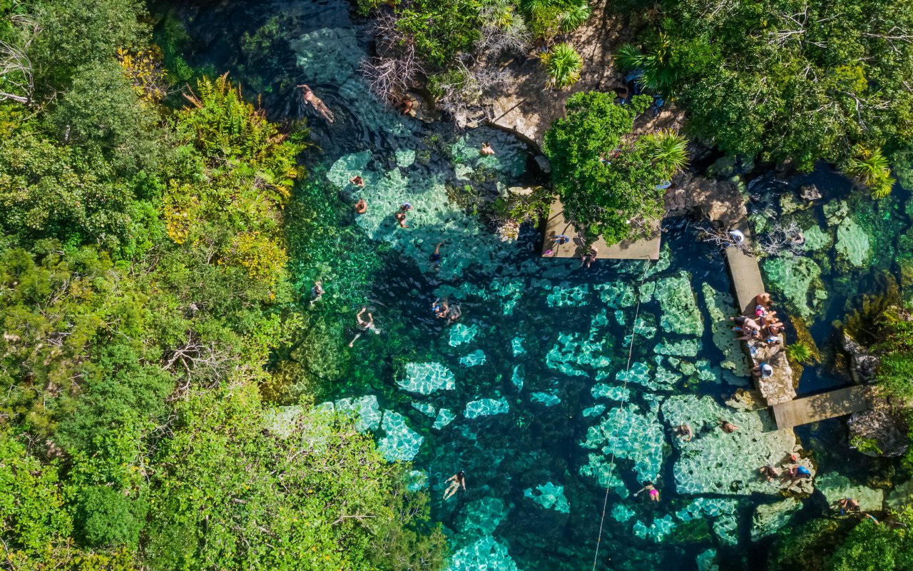
The town serves as the ferry departure point for Cozumel island and provides access to numerous cenotes within a 30-kilometer radius, including Dos Ojos, Gran Cenote, and Cenote Azul.


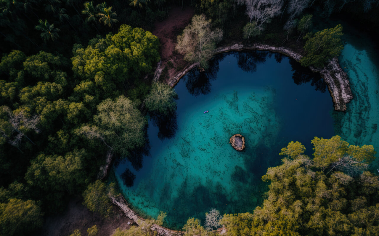
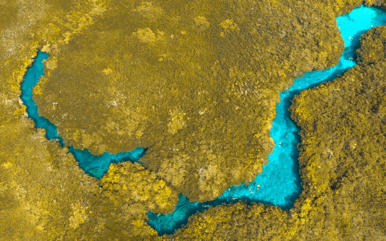
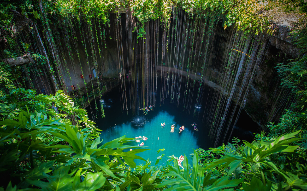
Underground river systems and cenotes
The Yucatán Peninsula contains over 6,000 known cenotes, with Quintana Roo hosting some of the most extensive underwater cave systems on Earth. The Sac Actun system stretches 347 kilometers underground, while Dos Ojos connects to over 82 kilometers of surveyed passages.
These formations result from the dissolution of limestone bedrock over millions of years, creating caverns that filled with fresh water as sea levels rose. The Maya considered cenotes sacred portals to the underworld, and archaeologists have recovered ceremonial offerings including jade, gold, and human remains from dozens of sites.
Modern cenote diving and snorkeling allows access to cathedral-like chambers with stalactites and stalagmites formed over millennia, while providing habitat for endemic species like blind cave fish and white crabs.
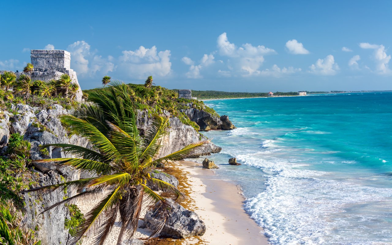
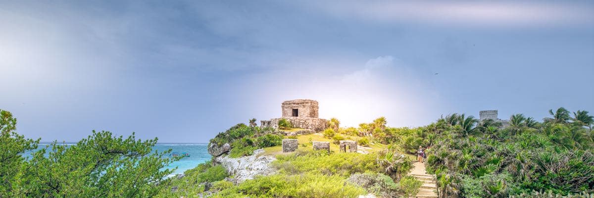
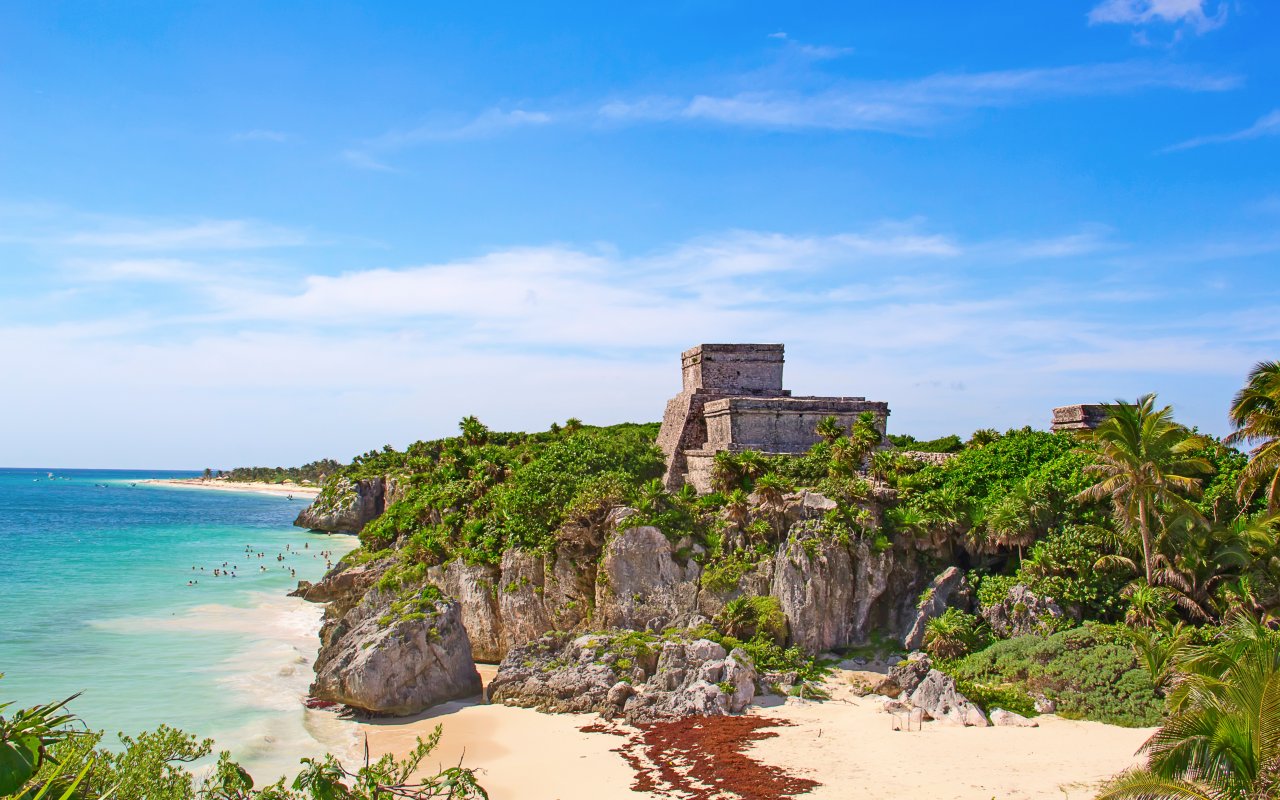
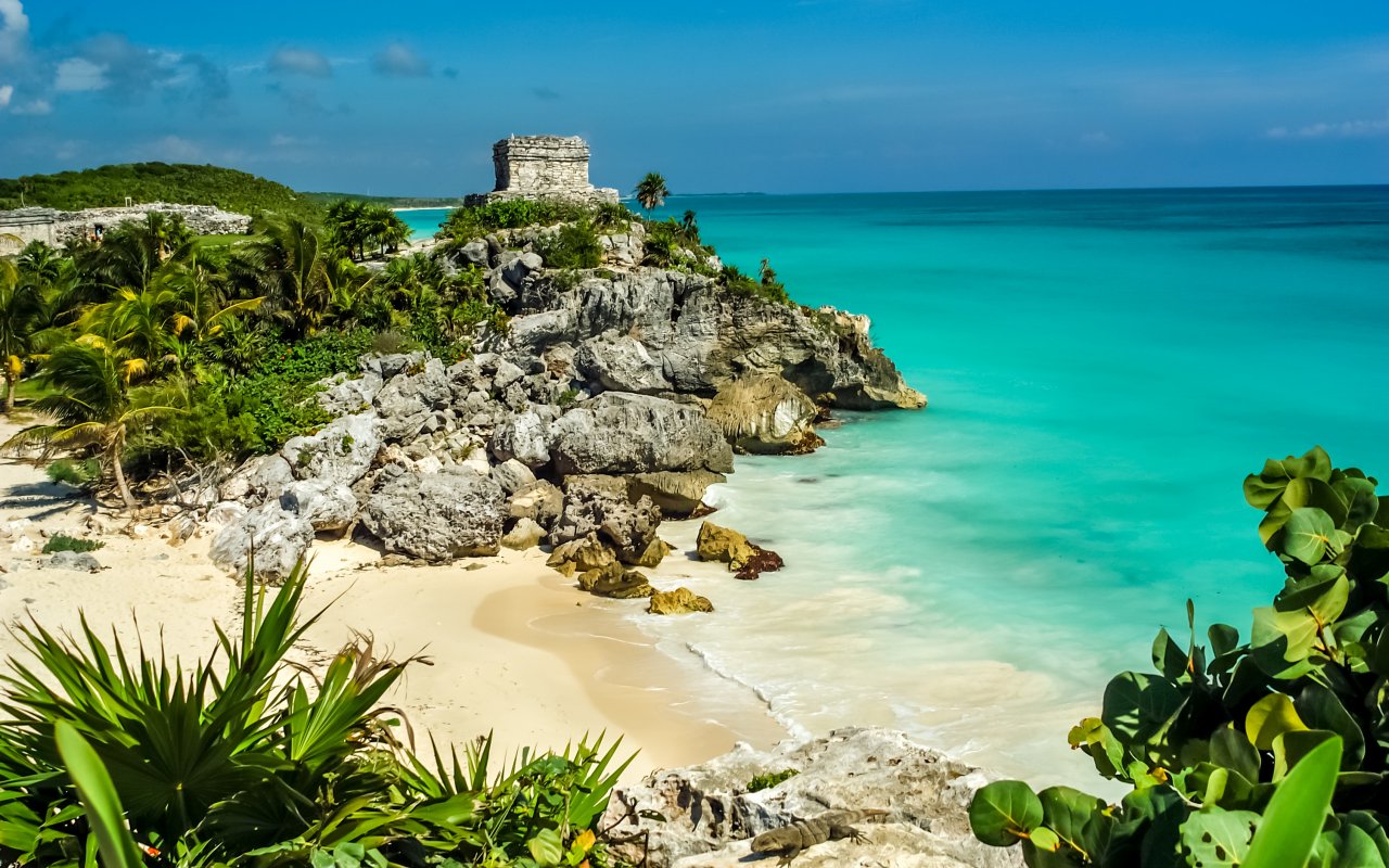
Archaeological corridor & Tulum
The coastal highway between Cancún and Tulum passes numerous Mayan sites that controlled trade routes along the Caribbean coast. Tulum occupies a clifftop position overlooking the sea, serving as both a fortress and trading port from 1200-1500 CE.
Cobá lies 45 kilometers inland, connected to coastal settlements by sacbeob (white roads)—raised limestone causeways that enabled rapid communication across the jungle. The site’s 42-meter-high Nohoch Mul pyramid remains climbable, offering views across the forest canopy to distant lagoons.
These sites demonstrate sophisticated understanding of astronomy, with structures aligned to track solar and lunar cycles for agricultural and ceremonial purposes.

Marine ecosystems and conservation
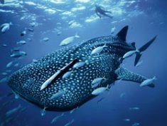
The Mesoamerican Reef extends 1,000 kilometers from Isla Contoy to Honduras, supporting marine biodiversity that includes whale sharks, sea turtles, and spawning aggregations of Nassau grouper. However, the reef has lost approximately 80% of its coral cover since the 1970s due to bleaching events, pollution, and coastal development.
Conservation efforts include coral restoration programs, marine protected areas, and sustainable tourism certification for dive operators. The Coral Restoration Foundation operates nurseries that grow staghorn and elkhorn corals for transplantation to degraded reef sites.
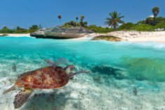
Three sea turtle species nest on Quintana Roo beaches: loggerhead, green, and hawksbill turtles return annually between May and October, with volunteers monitoring nests and protecting hatchlings during their journey to the sea.